Thunderstorm - February 20th, 2010
 2020-02-20 (IPMA)
Thunderstorm - February 20th, 2010
Weather in Madeira 10 years later
Following episodes of heavy rainfall in late 2009 and during 2010, in particular that associated with the well-known storm that hit Madeira Island on February 20, 2010, it was recognized from the outset that it would be indispensable strengthen meteorological observation in Madeira, in particular the network of automatic meteorological stations (EMAs).
On February 20, 2010, the Archipelago of Madeira had 9 EMAs, of which 2 had been installed in 2009 (Caniçal and Santa / Lombo da Tuesday). Today the Archipelago of Madeira has 21 EMAs which allow you to monitor the weather in real time (hour by hour), in particular with regard to episodes of heavy precipitation, high air temperatures and strong wind.
In view of the absence of observations at sea, it was also recognized that it would be essential to install a meteorological radar and a network of thunderstorm detectors that would allow, in a timely manner and by remote observation, to diagnose and monitor the evolution of the weather, particularly in the which refers to precipitation.
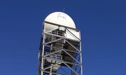
Thus, with the financial support of projects submitted to POSEUR, it was possible to install a dual polarization weather radar during 2017, having started operating on January 1, 2018, the installation in mid 2019. , a new altitude observation system (MW41) that allows the use of state-of-the-art radiosonde and the installation of a network of thunderstorm detectors during 2019, which is in the pre-operational phase, but which is expected to start operating in mid-March 2020.
In addition, the island of Madeira has unique characteristics in Portugal, due to the fact that it has relatively small dimensions, presents a mountain with a maximum altitude of the order of 1850 m, very steep slopes and an orientation perpendicular to the predominant north / northeast circulation . In this context, the numerical models of weather forecasting present some limitations, which come, namely, from the simplified representation of the island's topography. In this way, all the aforementioned observation systems made it possible to improve the performance of the ECMWF and AROME models for the Madeira region, ensuring, for example, the reduction of errors in forecasting parameters close to the surface such as temperature, relative humidity and wind, as well as monitoring the areas where rainfall occurs, including snowfall.
Another relevant and transversal project, financed by POSEUR, and being implemented at IPMA / headquarters, consists of a new Integrated Visualization System of meteorological information that will allow meteorologists who are in charge of monitoring and forecasting the weather throughout the national territory. , improve the quality of services provided to the population in general, to the media and to Civil Protection, with regard essentially to the safety of lives and property, particularly in situations of high meteorological danger.
A general analysis of what has been done in RAM and at the national level, allows us to recognize that there have been significant improvements in the means of observation and forecasting, in addition to the reformulation of the issue of meteorological warnings in the Madeira Archipelago that, in principle, they can make it safer, although the high vulnerability to extreme phenomena, which have already been experienced and which will certainly be associated with climate change, can be ruled out, clearly visible by the increase in average air temperature, more frequent heat waves and substantial changes in precipitation and wind patterns.
It should be noted that the highest annual rainfall in Funchal was recorded in 2010 (1477.0 mm) and the lowest in 2019 (244.5 mm). The average annual temperature in Funchal in 2019 was 20.6 ° C, equal to the value recorded in 2004 (20.6 ° C), these being the highest average annual values recorded since 1865.
Acknowledgment: Portugal 2020, POSEUR - Operational Program Sustainability and Efficiency in the Use of Resources
Imagens associadas
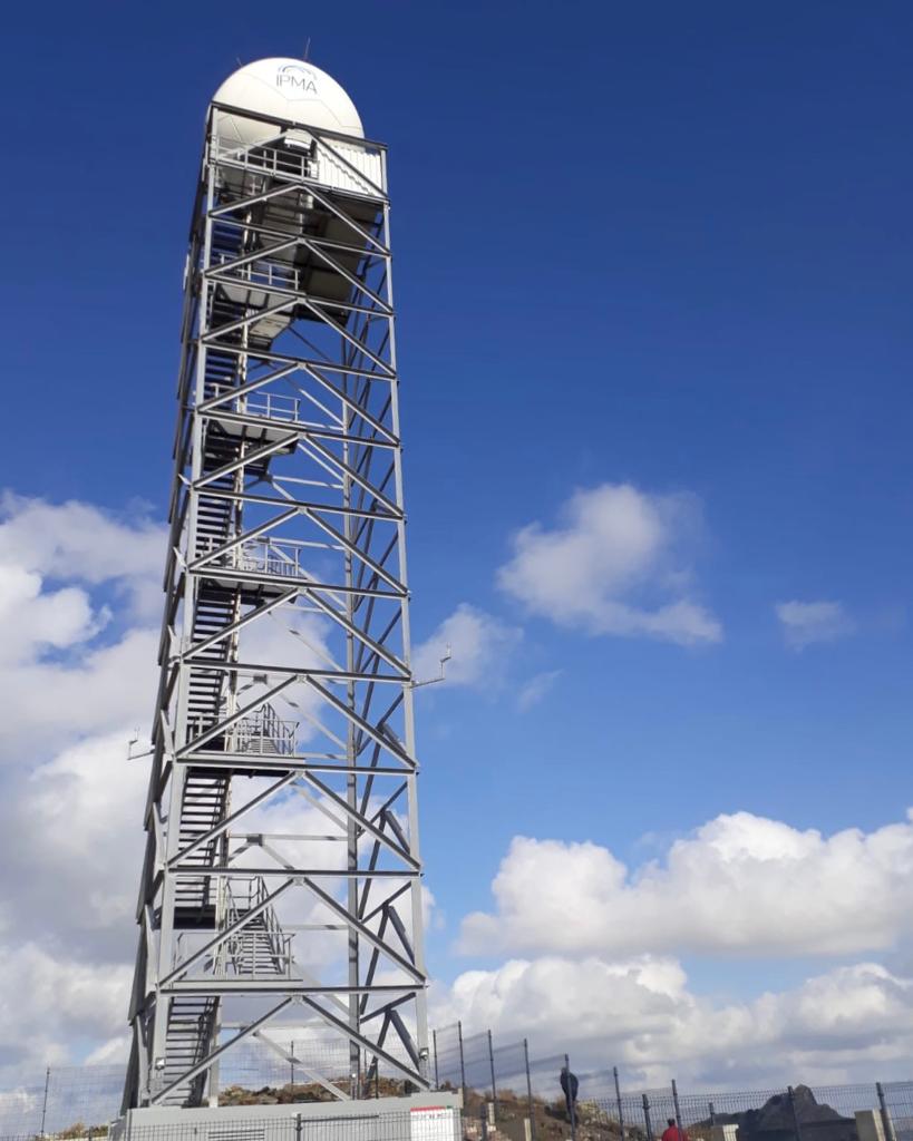
Image from the RADAR system tower that allows covering Madeira Archipelago, located at Pico do Espigão, in Porto Santo

-
Lisboa:
UTC:
Copyright © Portuguese Institute for Sea and Atmosphere 2026
-
