News
-
Groundbreaking study as part of GENEMARE
-
Project partners gather in Montpellier
-
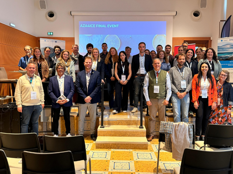
Final event of the AZA4ICE project in France


RADAR network
SATELITE | RADAR | LIGHTNING
"RADAR" is an acronym (english, RAdio Detection And Ranging) quite self explanatory, since it shows that radars do detect and locate targets while sending radio frequency electromagnetic waves into the atmosphere.
Radars that we use in meteorology, namely the ones that IPMA exploits, scan atmospheric volumes in a way that supports weather forecasters regarding the accomplishment of their activities; for instance, they are used to identify where and how much will rain, in the short term and, sometimes, to identify severe weather phenomena signatures. These radars supply wind information, as well. Currently, Coruche/Cruz do Leão and Loulé/Cavalos do Caldeirão form the portuguese weather radar network.
C band Doppler weather radar systems (aproximately 5cm wavelength), as the ones we exploit, measure:
- power returned back to the antenna, as a result of targets such as precipitation drops, droplets or even hail stones; the power is converted into reflectivity. This value, represented by Z, is proporcional both to the concentration and diameter of the targets, especially depending on the size. A conversion into rainfall intensity can be achieved by the use of the so called Z-R relationships;
- the speed of targets (such as precipitation drops) relative to the radar; for this evaluation, the light Doppler effect is used (physical principle similar to the sound Doppler effect) as the waves travel along moving targets.
dBZ is the reflectivity unit. The physical meaning of this unit is very hard to interpret; nevertheless, one can think of larger Z values to correspond to larger drops and/or larger hail stones.
dBZ turns into mm/h as long as reflectivity is converted into rainfall intensity. In this case, the physical meaning of the unit is the same than the one we get from surface classic weather stations. Radar observation is discrete; so, should radar observation be performed with 5 minutes interval and, for instance, a value of 15 mm/h is recorded by the radar on every observation performed in one hour period, it can be assumed to have a 15 mmm rainfall acumulated value (rainfall intensity assumed to be uniform during the time betwen observations.
The speed unit is m/s.
Currently, our Web page presents the following products:
Maximum returns of Reflectivity (dBZ) – available for each radar location every 30 minutes -, Rainfall Intensity (mm/h) – available for the radar composite every 30 minutes – and Hourly rainfall accumulation (mm) – available both for each radar location and for the radar composite every 30 minutes.
- Maximum returns of Reflectivity
It represents the maximum reflectivity return observed in the atmosphere and projected onto the horizontal (visible in the image center); in the right side panel of the image is represented the maximum reflectivity return in the east west direction and the maximum reflectivity return in the north south direction is represented in the remaining side panel.
This product is used to identify and monitor convective clouds, such as Cb's; these clouds are frequently associated with strong showers, thunderstorms and even hailfall; these cloud types are usually depicted in the product images as large reflectivity cores surrounded by lower reflectivity values.
- Rainfall Intensity
It represents the rainfall intensity field close to the ground; however, due to radiation propagation effects on the atmosphere, values observed at large ranges (eg over 120 Km from the radar site) are observed at higher altitudes, thus preventing the observations to be representative of near ground phenomena at those ranges.
- Hourly rainfall accumulation
It represents the hourly integration of the rainfall intensity field. The comments produced about the rainfall intensity product are still valid for this one.
In every product there is an image scale, where cold colors (blueish) are associated with the lower values and warm colors (redish) to the higer ones.

-
Lisboa:
UTC:
Copyright © Portuguese Institute for Sea and Atmosphere 2026
-
