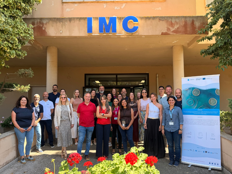
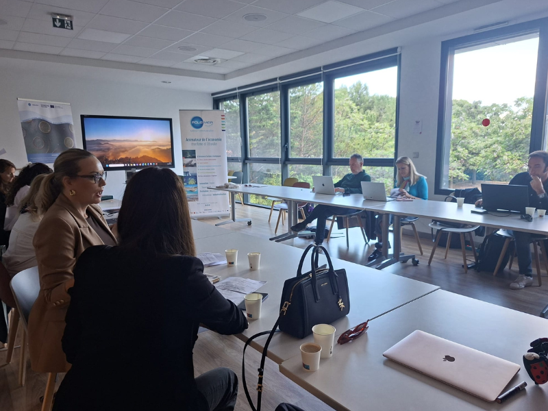
Instituto Portugues do Mar e Atmosfera - Homepage

  • Who we are | 
  • Where we are | 
  • Scientific Council | 
  • Research | 
  • eLibrary | 
  • ipma encyclopedia  | 
  • Contacts | 
  • Português
  • Weather
    • Weather forecast
    • 10 days and hourly forecast
    • Weather Warnings
    • Meteorological charts
    • Vertical profile
    • Satellite observations
    • Radar
    • Lightning
    • Solar Radiation
    • Online weather stations
    • World forecast
    • Tropical cyclones forecast
    • Report a meteorological phenomenon?
  • Seismic
    • Seismic maps
    • Shakemap
    • Felt an earthquake?
    • Moment Tensor
    • Networks
    • Bulletins
    • Projects
  • Sea
    • Beaches and ports
    • Marine forecast
    • Significant wave height
    • Sea peak period
    • Surface current
    • Sea surface temperature
    • Sea surface height
  • Climate
    • Climate Monitoring
    • Climate Normals
    • Daily monitoring
    • Long data series
    • Monthly monitoring
    • Drought
    • Greenhouse gases
    • Climate Extremes
    • Climate web portal
    • Climate Services
  • Bivalves
    • Bivalves - Situation point
    • Legislation and Documents
    • Production areas
    • Biotoxins
    • Phytoplankton
    • Contaminants Metals
    • Microbiology
    • Bivalves - historical
  • Fisheries
    • Disclosure
    • Projects
    • Fish management
    • ICES
  • Aeronautic
    • TAF and METAR
    • Self Briefing
    • Know more
  • Agriculture
    • Soil Moist Index
    • Vegetation Health Index (VHI)
    • Fraction of Absorbed Radiation (FAPAR)
    • More information
    • Agroclimatic platform
  • Health
    • Ultra-violet index
    • Ozone
    • Pollen
    • Air temperature
  • Vessels
    • Framework
    • RV Mário Ruivo
    • RV Diplodus
    • Maris
    • Recife II
    • Cardium
  • Space
    • MSG satellite
  • Rural Fires
    • Mainland Rural Fire Danger
    • Madeira Rural Fire Danger
    • Reports Rural Fire Danger

News

  • 1st Meeting GOOS/EOOS

    EOOS logo European Ocean Observing System
    Mon May 05 09:00:00 UTC 2025
  • Diplodus in Total Requalification

    Total Requalification of IPMA Vessel Total Requalification of IPMA Vessel
    Fri May 02 09:00:00 UTC 2025
  • Iberian Symposium SIMERPE 3

    SIMERPE 3 Symposium on the Evaluation of Fisheries Resources
    Fri May 02 09:00:00 UTC 2025
  • More news
IPMA>Encyclopedia IPMA>Weather>

Meteorological Warnings User’s Guide

User’s Guide | Criteria for the Issuance


It is responsibility of IPMA to ensure weather watch and to issue warnings whenever adverse meteorological events are predicted or observed.
The purpose of this page is to warn the Civil Protection Authorities and the general public of the occurrence of hazardous weather conditions that may cause damage within 24 hours.
Warnings are issued at district level for different meteorological parameters. A range of colours reflects the intensity of the phenomenon.

The colours mean:

Description.
Gray Information being updated.
 
Green No hazardous weather conditions foreseen.
 
Yellow Weather sensitive activities may be affected.
Pay attention to the development of weather conditions.
Orange Weather conditions involving moderate to high risk.
Keep informed of their development and follow the advice of the Civil Protection Authorities ANEPC.
Red Weather conditions involving high risk.
Keep informed of their development and follow the advice of the Civil Protection Authorities ANEPC.

Warnings are issued in case of: strong wind, heavy rainfall, snowfall, thunderstorm, cold, heat, persistent fog and sea disturbance.

Taking into account the different characteristics of weather events, their incidence and effects, Issuance Criteria (see criteria) have been established.

If a warning is issued for two or more different parameters, for instance wind and rainfall, with different warning levels, the district will appear in the colour and with the icon corresponding to the higher risk. Information on the second parameter will be shown on clicking on the district.

For further information on the warning, view the districts and islands listed on the left of the map.

When warnings are issued, please be informed of the advices and self-protection actions divulged by: National Service of Fire Combat and Civil Protection - AENPC (Civil Protection ) by:  Directorate General for Health - D.G.S. (Direção-Geral da Saúde).


  • Media

    • News
    • Communiqué
    • Lectures / workshops
    • YouTube
    • IPMA on Educast
  • Social network

    • Facebook
    • Facebook - Azores
    • Twitter
    • Instagram
  • Services

    • Products and services
    • RSS
    • Apps Android
    • Apps Apple
    • PDA
  • Information

    • Contact
    • Useful links
    • Research scholarship
    • EEAGrants projects
    • ECMWF
  • About site

    • Accessibility
    • Legal warnings
    • Site Map
  • Web projects

    • Observar
    • Subscriptions
    • Survey
    • E-learning
    • Shakemap
 
  • Apcer - A marca da Certificação
  • Lisboa:
        UTC:

    Copyright © Portuguese Institute for Sea and Atmosphere 2025
  • Ministério da Economia Ministério Agricultura e Pescas