Instituto Portugues do Mar e Atmosfera - Homepage

  • Who we are | 
  • Where we are | 
  • Scientific Council | 
  • Research | 
  • eLibrary | 
  • ipma encyclopedia  | 
  • Contacts | 
  • Português
  • Weather
    • Weather forecast
    • 10 days and hourly forecast
    • Weather Warnings
    • Meteorological charts
    • Vertical profile
    • Satellite observations
    • Radar
    • Lightning
    • Solar Radiation
    • Online weather stations
    • World forecast
    • Tropical cyclones forecast
    • Report a meteorological phenomenon?
  • Seismic
    • Seismic maps
    • Shakemap
    • Felt an earthquake?
    • Moment Tensor
    • Networks
    • Bulletins
    • Projects
  • Sea
    • Beaches and ports
    • Marine forecast
    • Significant wave height
    • Sea peak period
    • Surface current
    • Sea surface temperature
    • Sea surface height
  • Climate
    • Climate Monitoring
    • Climate Normals
    • Daily monitoring
    • Long data series
    • Monthly monitoring
    • Drought
    • Greenhouse gases
    • Climate Extremes
    • Climate web portal
    • Climate Services
  • Bivalves
    • Bivalves - Situation point
    • Legislation and Documents
    • Production areas
    • Biotoxins
    • Phytoplankton
    • Contaminants Metals
    • Microbiology
    • Bivalves - historical
  • Fisheries
    • Disclosure
    • Projects
    • Fish management
    • ICES
  • Aeronautic
    • TAF and METAR
    • Selfbriefing
    • Know more
  • Agriculture
    • Soil Moist Index
    • Vegetation Health Index (VHI)
    • Fraction of Absorbed Radiation (FAPAR)
    • More information
    • Agroclimatic platform
  • Health
    • Ultra-violet index
    • Ozone
    • Pollen
  • Vessels
    • Framework
    • RV Mário Ruivo
    • RV Diplodus
    • Maris
    • Recife II
    • Cardium
  • Space
    • MSG satellite
  • Rural Fires
    • Mainland Rural Fire Danger
    • Madeira Rural Fire Danger
    • Reports Rural Fire Danger

News

  • Argo Program

    IPMA deployed new floats
    Wed Dec 03 08:00:00 UTC 2025
  • EMSO Portugal

    Miguel Santos is the new president
    Wed Dec 03 08:00:00 UTC 2025
  • Mission Project

    First face-to-face meeting
    Thu Nov 13 09:00:00 UTC 2025
  • More news
IPMA>Climate>Services

Climate services

  • Introduction

Highlight products

  • Portal do Clima link externo
  • >Climate scenarios XXI

Reference produtcs

  • Climatological Normals
  • Climate atlas, Iberic P.
  • Precipitation dataset PT02

Clima services - climate atlas

Atlas Ibérico

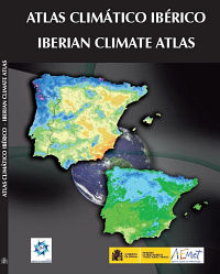
The climatological atlas is a means to present, in graphic form, a synthesis of knowledge concerning the climate of a country or a region, which is intended for a wide range of users.

Given the geographical unit of the Iberian Peninsula the development of this atlas was an advantage for the continental territories of Portugal and Spain.

The basic information used in the preparation of the atlas was the climatological normal (average) for the period 1971-2000, according to the recommendations of the WMO.

Download Climate Atlas from Iberian Peninsula » Icon pdf


  • Media

    • News
    • Communiqué
    • Lectures / workshops
    • YouTube
    • IPMA on Educast
  • Social network

    • Facebook
    • Facebook - Azores
    • Twitter
    • Instagram
  • Services

    • Products and services
    • RSS
    • Apps Android
    • Apps Apple
    • PDA
  • Information

    • Contact
    • Useful links
    • Research scholarship
    • EEAGrants projects
    • ECMWF
  • About site

    • Accessibility
    • Legal warnings
    • Site Map
  • Web projects

    • Observar
    • Subscriptions
    • Survey
    • E-learning
    • Shakemap
 
  • Apcer - A marca da Certificação
  • Lisboa:
        UTC:

    Copyright © Portuguese Institute for Sea and Atmosphere 2025
  • Ministério da Agricultura e Mar